Map
implementedin consultation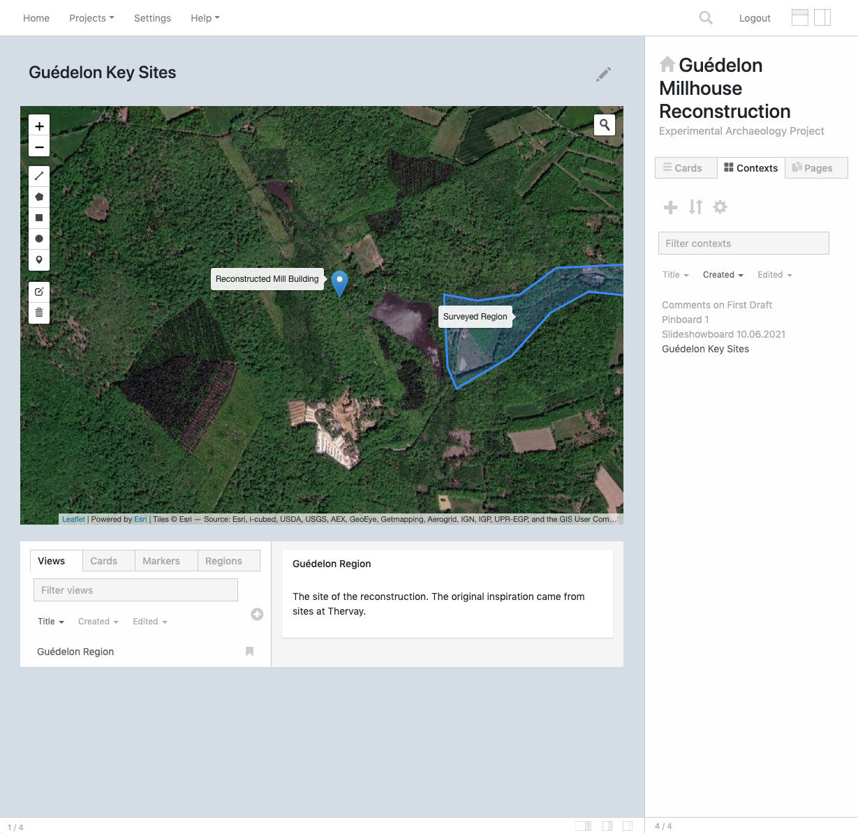
The Map context allows you to save maps with different tilesets. It's based on the leaflet library and offers tilesets (map types) from a range of providers. For each element added to the map, the Map context creates an associated editable card with a title and body, which can contain markdown text and images. You can also pin existing Orsn cards to the map.
- Add cards and pin them to the map
- Save views of map areas
- Add markers to the map
- Draw lines and polygons on the map
- Annotate views, markers, lines and polygons with labels and descriptions
How to use
- Use the toolbar on the left of the map to add markers, lines and polygons. When you create a new map item, an associated card will be created and displayed in the preview pane.
- To edit existing map items, click on the pencil icon in the map toolbar. When you are finished editing, click 'Save' or 'Cancel' to leave edit mode.
- To add an existing Orsn card to the map, either drag and drop a card from the
Cardssidebar, or add the card to the map context. Then select theCardstab in the Map context, and click on the card's title to preview it. In the preview panel you will see an option ( icon) to add the card to the current location in the map. - To create a new view, click on the plus icon in the list of views.
- You can create multiple views, then select one of them as the default by clicking on its bookmark icon , in the list of views. When the context loads, this is the view which will be displayed.
- Each view has its own hyperlink. You can link to the map with that hyperlink and display that particular view when it opens, even if it's not marked as the default view. To copy the link, click on the link icon by the view's title, in the list of views.
Controls
Click on the Map context's pencil icon to access its controls.
- Basemap type. Different basemaps provide different map 'tiles', e.g. aerial imagery, terrain or street map.
Notes
- The search option only looks within the current visible range of the map. To search for locations which are not visible, zoom out before typing your search term.